 .
. . . . . . .
. . . . . . |
 .
.
 .
. . . . . . .
. . . . . . |
|
|
|
|
|
|
THE MOVIES |
|
REDISCOVERED |
-
- AAPACHE PASS
 |
This
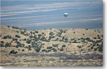
is an unusual aerial view of a blimp passing over the low divide between
the Dos Cabezas Mountains and the Chiricahua Mountains: Apache Pass.
In the center area of the photo you can make out a horizontal line that looks like a tan colored ribbon. This is part of the old Tucson Road, leading through Siphon Canyon, in the heart of the pass. It makes its way in snake-like fashion through incredibly narrow passes, forming a land bridge between the Sulphur Springs Valley and the San Simon Valley. It was in this narrow defile that history was made in February, 1861, and Cochise swore his vengeance on all Whites, leading to an 11 year period of blood-letting on both sides. (See the section BROKEN ARROW for the whole story). |

ALL THAT IS LEFT OF THE
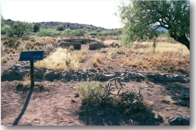
BUTTERFIELD STAGE STATION IN APACHE PASS.
|

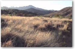
LOOKING WEST FROM A SPOT IN THE HEART OF APACHE PASS, VERY NEAR THE SPOT IN SIPHON CANYON WHERE THE FAMED "CUT THE TENT" INCIDENT OCCURED, LEADING TO COCHISE'S WAR. |
| Within
Apache Pass is Apache Spring, which in the days of the frontier was a crucial
stop for travelers attempting to traverse the area. The old Tucson
Road ran through this pass and particularly in the summer months the water
in the reliable springs was absolutely vital for both travelers and their
animals. It was no less important to the Chokonens, and the area
was one of Cochise's favorite camping spots for years before the Americans
ever set foot there.
It was the importance of this pass and the springs it contained that brought about the construction of Fort Bowie in 1862, following the famous Battle at Apache Pass (Broken Arrow). |
. .